These tools provide an excellent set of commands to exchange data between AutoCAD Civil 3D or BricsCAD Pro and HEC-RAS. They are included with SmartDraft Suite. They are not sold separately.
Key Features
Supports multiple river / reaches in the project and SDF files.
Edit Planview options to the Enter or Select Stations option of the Create Sample Lines or Polylines along an alignment command.
Elevation Adjustment option to the Create HEC-RAS Floodplain Lines command to adjust the water surface elevation.
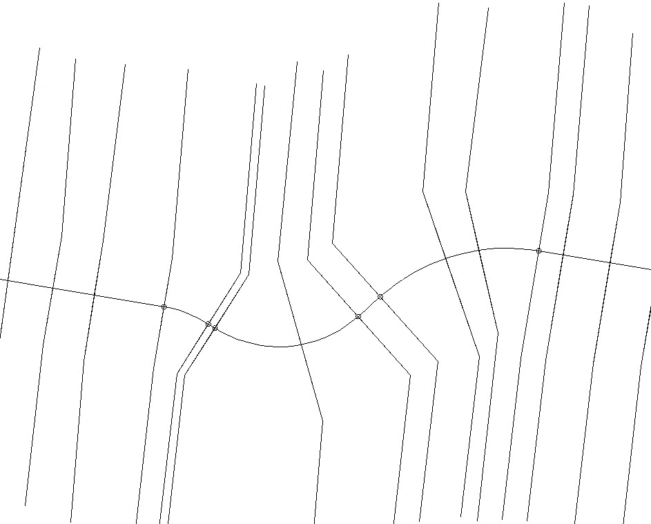
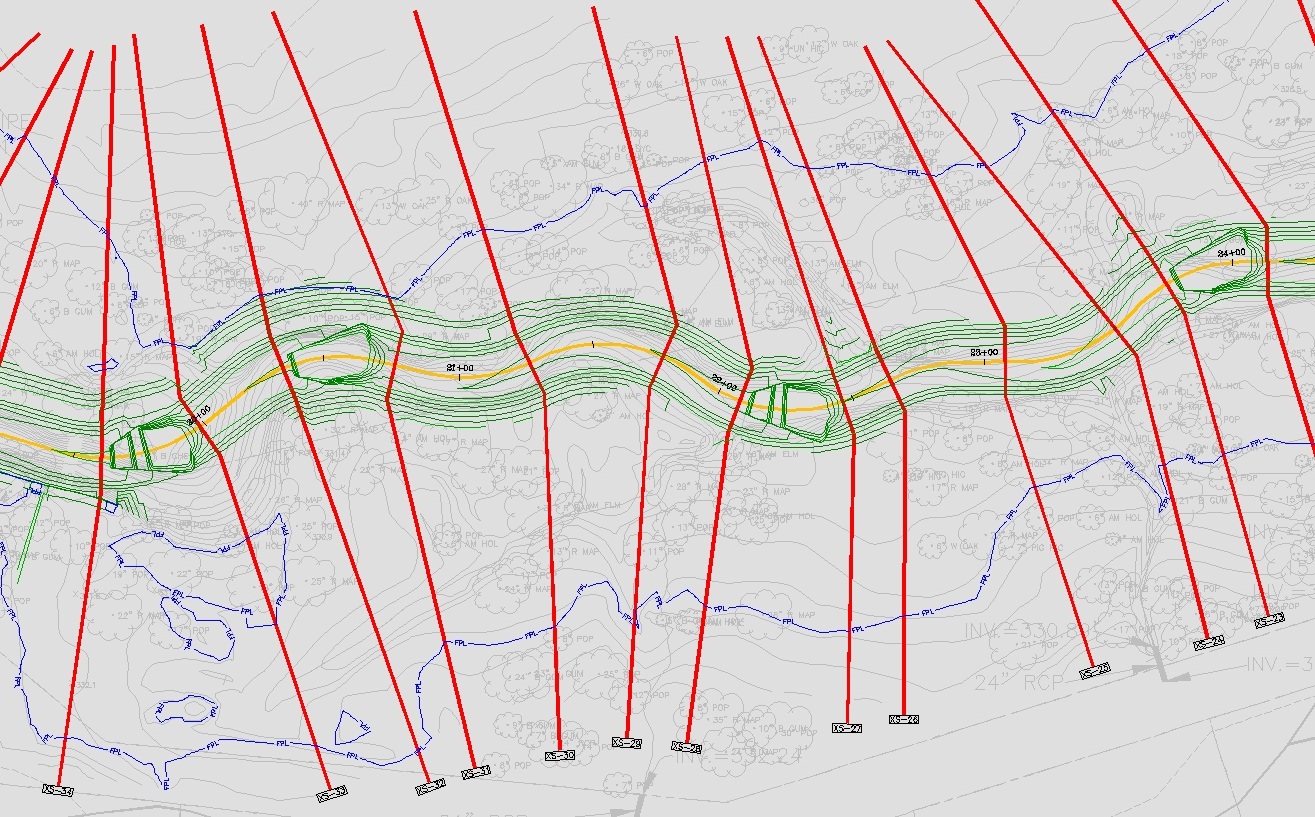
| Create Sample Lines or Polylines Along an Alignment: Video A tool to create AutoCAD Civil 3D Sample Lines or Polyline Section Lines at stations specified in a text file and/or stations entered by the operator. These section lines can be used by the “Create a HEC-RAS Project” and as additional cross section(s) by the “Add to a HEC-RAS Project” command. Creates four (4) segment section lines with internal vertices which coincide with the specified Top of Bank width. In the example to the right, the end points of the straight section lines originally created have been adjusted to better follow the channel grading and floodplain. |  |
| Create HEC-RAS Data: Video | A tool to create a HEC-RAS project with a geo-referenced reach centerline, reach lengths, bank stations, and cross section from AutoCAD Civil 3D or BricsCAD section lines, an alignment, and a surface. The command supports alignments with curves, reach lengths along the curves, and section lines as either polylines or AutoCAD Civil 3D Sample Lines. |
| Sample Line Tools (AutoCAD Civil 3D only): | A tool to rename by station or renumber with a prefix and suffix the AutoCAD Civil 3D Sample Lines associated to an alignment. |
| Add Sections to a HEC-RAS Project: | A tool to add additional cross sections to an existing HEC-RAS project from section lines, an alignment, and a surface within AutoCAD Civil 3D or BricsCAD. |
| Add River / Reach to a HEC-RAS Project: | Add new river / reach to a HEC-RAS Project using Sample Lines / Polylines, an alignment, a surface, and an existing HEC-RAS project. |
| Create HEC-RAS Planview Sections Lines and Labels: | A tool to read the cross section from a HEC-RAS GIS output (.sdf) file to create section lines and labels within AutoCAD Civil 3D or BricsCAD. The section lines are polylines which can be added to an alignment’s Sample Line Group. |
 |
| Create HEC-RAS Planview Sections Lines and Labels: | A tool to read the cross section from a HEC-RAS GIS output (.sdf) file to create section lines and labels within AutoCAD Civil 3D or BricsCAD. The section lines are polylines which can be added to an alignment’s Sample Line Group. |
| Create HEC-RAS Floodplain Lines: Video | A tool to read the floodplain delineation from a HEC-RAS GIS output (.sdf) file to create as floodplain lines within AutoCAD Civil 3D or BricsCAD. |
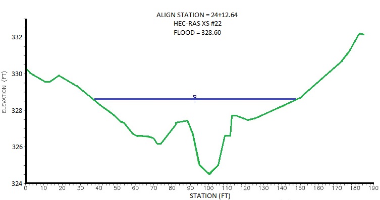
| Create HEC-RAS Cross Sections: Video A tool to draw the cross section from a HEC-RAS GIS output (.sdf) file within AutoCAD Civil 3D or BricsCAD. |  |
| Create HEC-RAS Water Surface Profile: | A tool to import the water surface profiles from a HEC-RAS GIS output (.sdf) file into an AutoCAD Civil 3D or BricsCAD drawing. |
| Label a HEC-RAS Water Surface Profile: | A tool to label a water surface’s stations and elevations, in the profile, from a HEC-RAS GIS output (.sdf) file into an AutoCAD Civil 3D or BricsCAD drawing. |
CADD Support Information: AutoCAD and BricsCAD version support
Supports: HEC-RAS 3.x – 6.x
